Eluru Through the Ages
From Heritage to Modern Development
 THEN
THEN NOW
NOWPedavegi – Ancient Capital of Vengi
Once the glorious capital of the Vengi Kingdom, today preserved as an important archaeological site.
 THEN
THEN NOW
NOWGuntupalli Buddhist Caves
Ancient Buddhist monastic caves, now a protected heritage site and tourist attraction.
 THEN
THEN NOW
NOWAncient Temples of Eluru
Timeless temples built during various dynasties, now restored and thriving centers of devotion.
 THEN
THEN NOW
NOWAncient Inscription at Pedavegi
Historical inscriptions that once recorded the legacy, now preserved for future generations.
 THEN
THEN NOW
NOWEluru Bridge during British Era
A historic bridge that connected hearts and places, now strengthened for modern connectivity.
 THEN
THEN NOW
NOWOld Collectorate Building, Eluru
Colonial era administrative building, now maintained as a symbol of heritage and governance.
 THEN
THEN NOW
NOWEluru Railway Station – A Historical View
From steam engines to modern electrified trains, Eluru stays connected through time.
 THEN
THEN NOW
NOWKolleru Lake – A Historical Wetland
Asia's largest freshwater lake, supporting livelihoods then and now with greater conservation.
 THEN
THEN NOW
NOWEluru Town in Early 1900s
From quiet streets of the past to a bustling modern city, growing with progress and opportunities.
District Information
Area Measurement of Eluru District
Overview
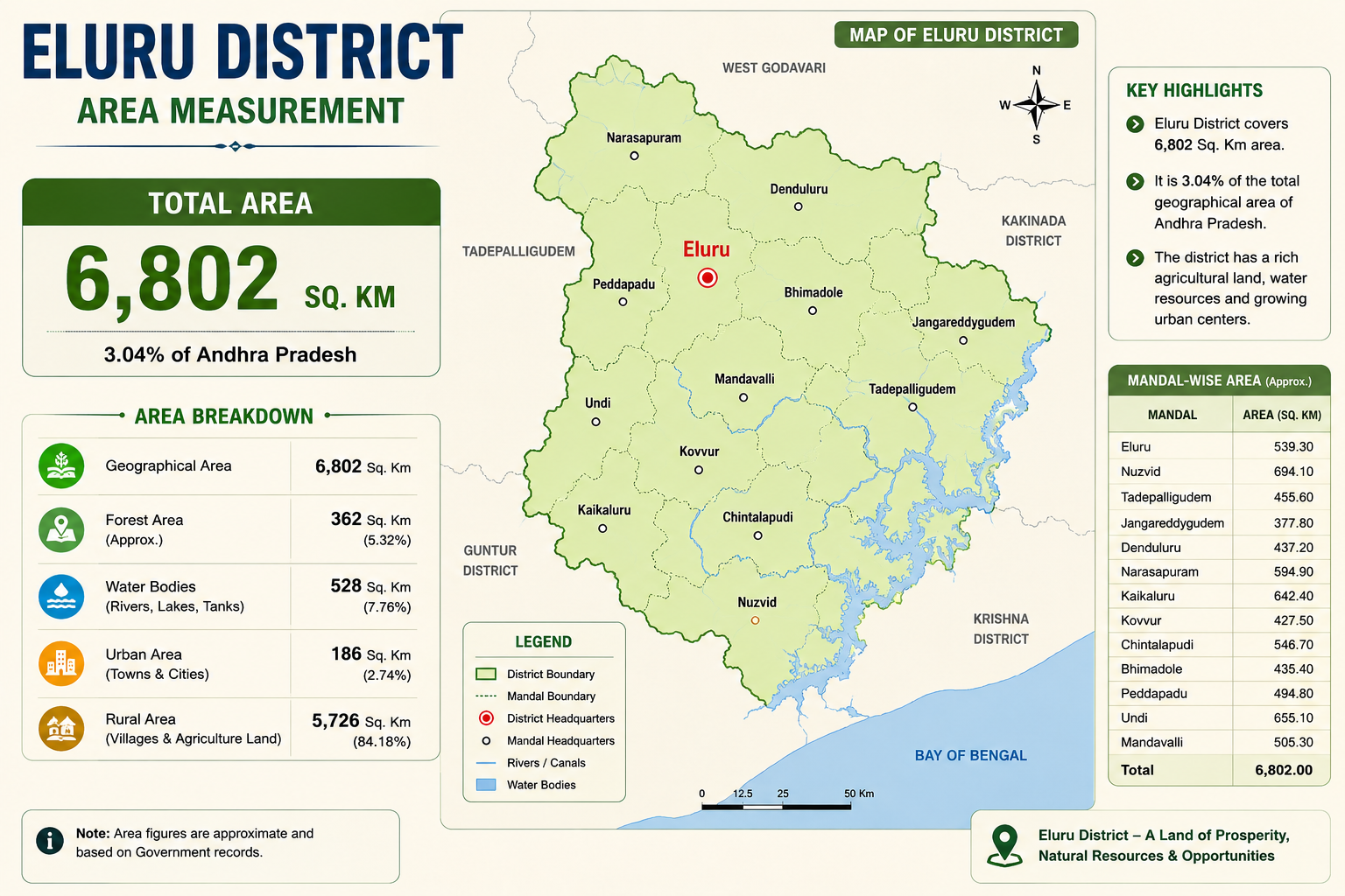
Eluru District covers approximately 6,802 square kilometres and represents about 3.04% of Andhra Pradesh's geographical area. The district is primarily agricultural, supported by fertile lands, irrigation canals, rivers and tanks.
Explore More →Major Towns & Places of Eluru District
Discover the municipalities, census towns and major mandal headquarters that contribute to the administration, culture, agriculture, tourism and economic development of Eluru District.
Overview
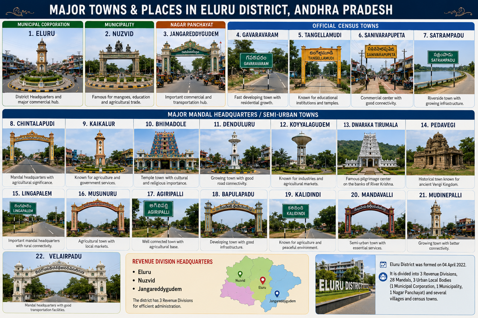
The infographic provides a comprehensive overview of the major towns and administrative centers of Eluru District, Andhra Pradesh, showcasing the district's well-organized administrative structure and urban development. It highlights the Municipal Corporation, Municipality, Nagar Panchayat, Official Census Towns, and Major Mandal Headquarters, each playing a significant role in the district's governance, economic growth, education, healthcare, agriculture, and tourism.